




Geotag your photos without GPS (but with a smartphone!)
Published on 26 October 2016
[](https://i0.wp.com/www.macarel.fr/wp-content/uploads/2016/10/geotag05.png)
One of the nice things about taking photos with an iPhone is that they're automatically located in the photos' EXIF data.
What's EXIF data? Well, information about your camera, the settings used at the moment the photo was taken, etc.
All this information is hidden in the JPG (or RAW) of your photo, and you can read it via the "information" of your images under Windows or macOS.
Today most software that archives your photos can display "the place" where they were taken, and it's really cool, whether on your phone or your computer.
Yes but there you go, sometimes you also take photos with a DSLR (a mirrorless in my case), and in that case, unless you've bought a dedicated GPS, it's game over for having GPS info in your photos.
That's where your smartphone is going to save you, thanks to the Geotag app, which I've been using for a few months (available on iPhone and Android). The idea is simple, you launch the app, which will analyze your movements during your shoots and your trips, then you just have to easily retrieve the data and sync it with your photos.
Alright, I'll walk you through it step by step, and in pictures, so you can try it out on your side, ok?
What do you need?
- Your smartphone, with the Geotag app installed on it, for iPhone or for Android.
- Your camera, with stuff to photograph.
AND OFF WE GO FOR THE WALK.
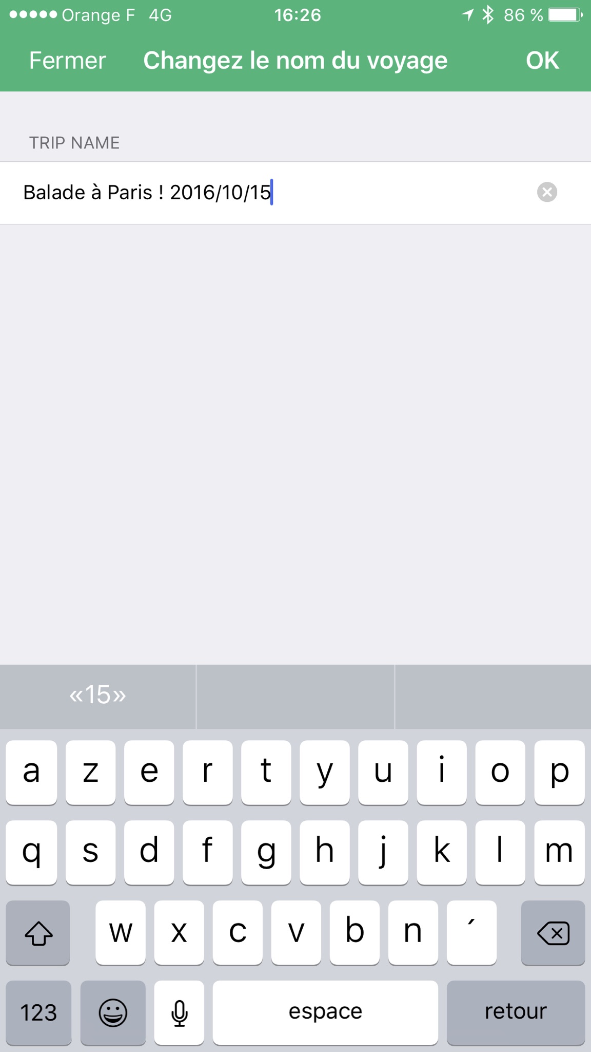
When it's time to leave, choose a name for your route, in my case it was a walk in Paris:
[](https://i0.wp.com/www.macarel.fr/wp-content/uploads/2016/10/geotagiPhone01.png)
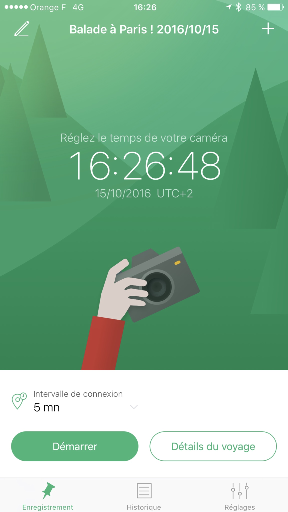
Once the name is chosen, check that your phone's time is exactly the same as your camera's, it's essential (watch out for time differences when you're abroad):
[](https://i0.wp.com/www.macarel.fr/wp-content/uploads/2016/10/geotagiPhone02.png)
Choose a logging interval, basically it's the frequency at which the GPS point will be recorded. If you walk slowly or if you're doing a long route, choose a long interval, like 5 minutes. If you tend to move fast, choose 30 seconds, or even less. The shorter the interval, the more your battery will be taxed:
[](https://i0.wp.com/www.macarel.fr/wp-content/uploads/2016/10/geotagiPhone03.png)
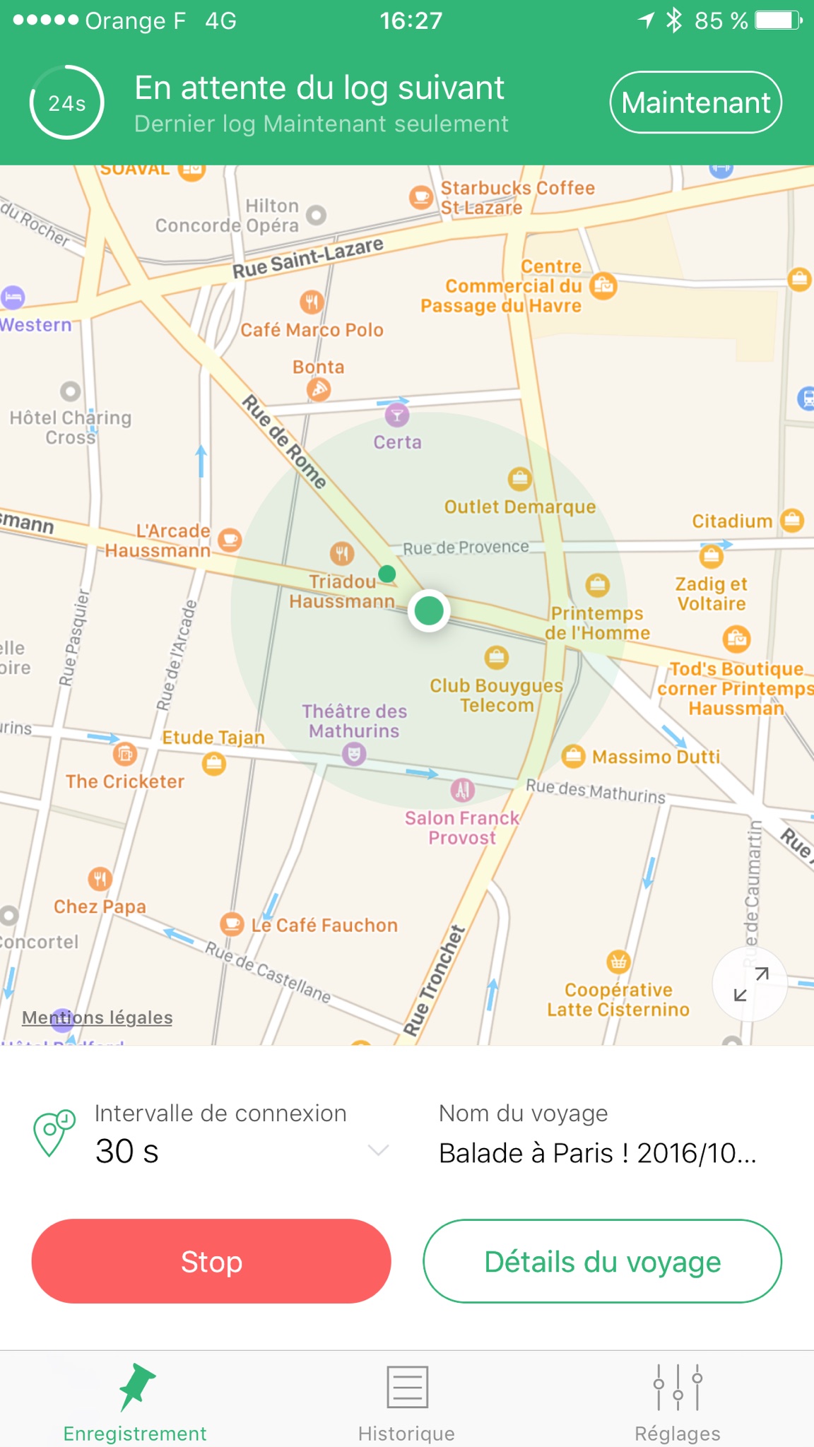
In my case I set 30 seconds, and off we go to wander around the city, taking lots of photos of Paris!
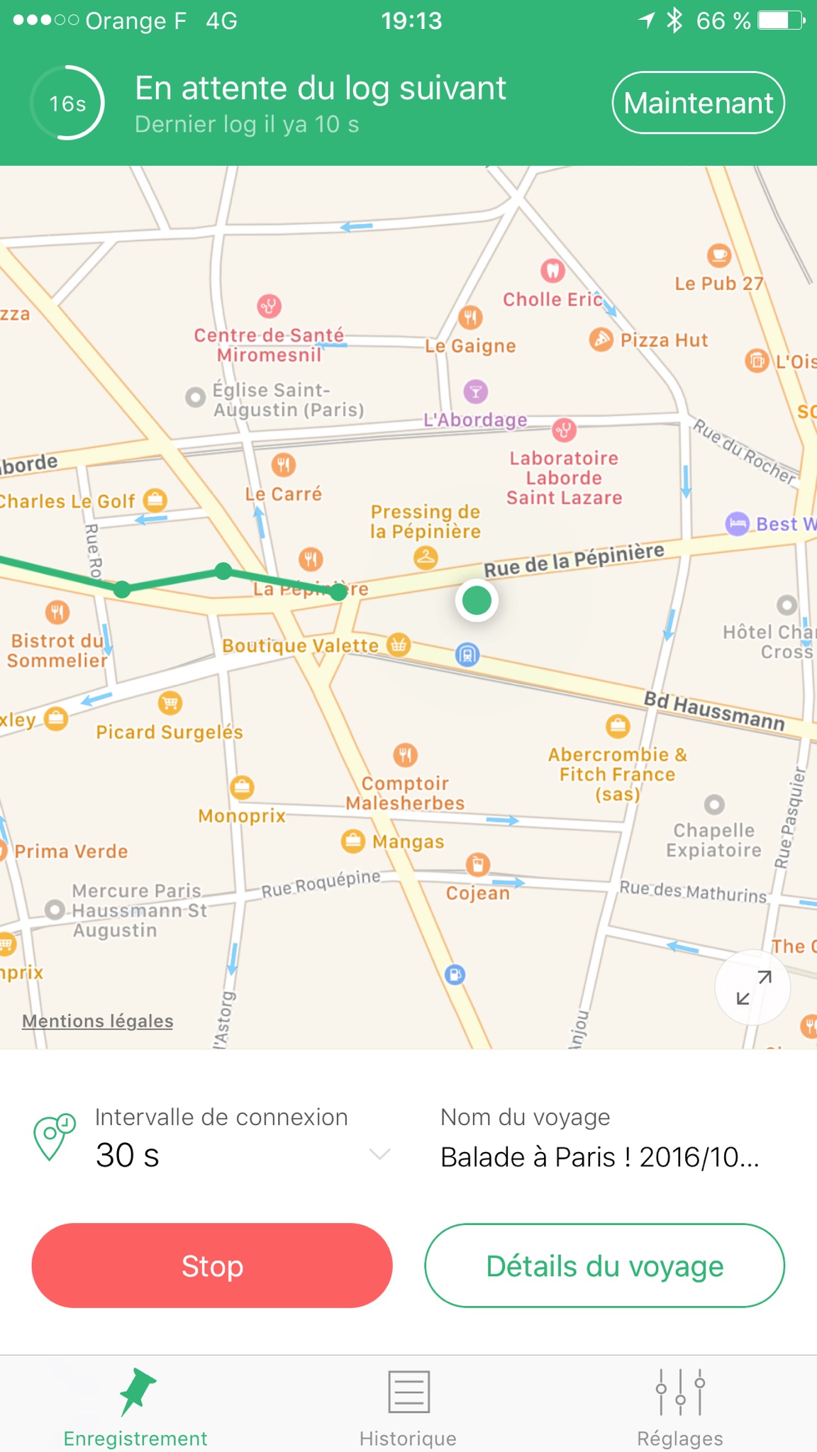
[](https://i0.wp.com/www.macarel.fr/wp-content/uploads/2016/10/geotagiPhone04.png)
During my walk, I can see my route in real time on the map:
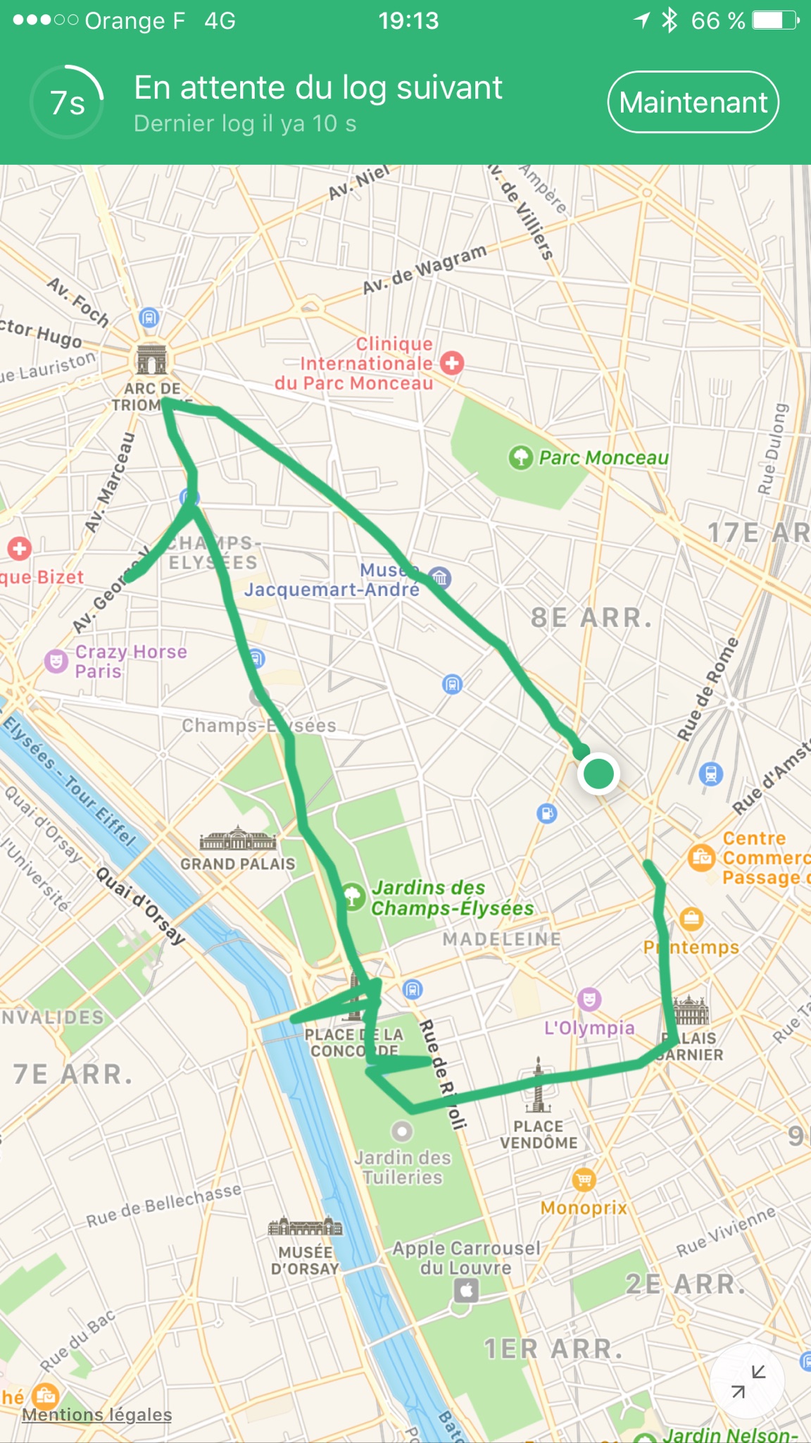
[](https://i0.wp.com/www.macarel.fr/wp-content/uploads/2016/10/geotagiPhone05.png)
And there's my whole route! Quite a hike, then!
At this stage, you head home, you offload your memory card onto your computer, and you retrieve the data recorded by your phone. To do so, you go to your travel history, and you click on "Share trip":
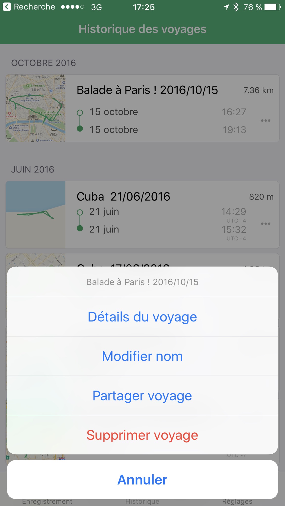
[](https://i0.wp.com/www.macarel.fr/wp-content/uploads/2016/10/geotagiPhone06.png)
Personally I prefer to send the file via AirDrop, but it'll also work perfectly by email or otherwise.
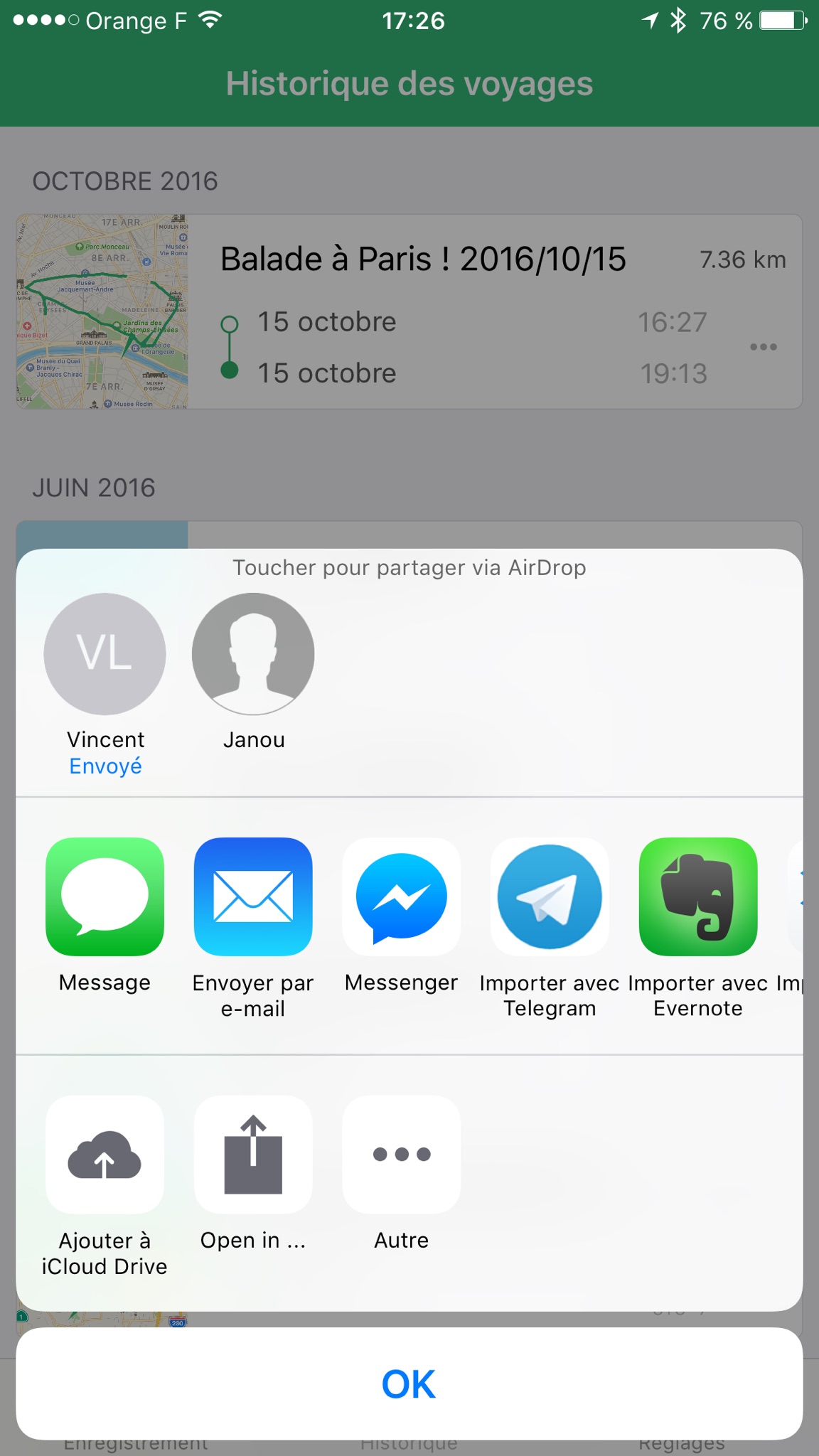
[](https://i0.wp.com/www.macarel.fr/wp-content/uploads/2016/10/geotagiPhone07.png)
There you are with a nice file, in my case it's called "2016-10-15 – Walk in Paris! 2016_10_15.gpx"!
Now you need to install Geotag Pro on your computer. You can download it here.
Done? Alright, let's launch it:
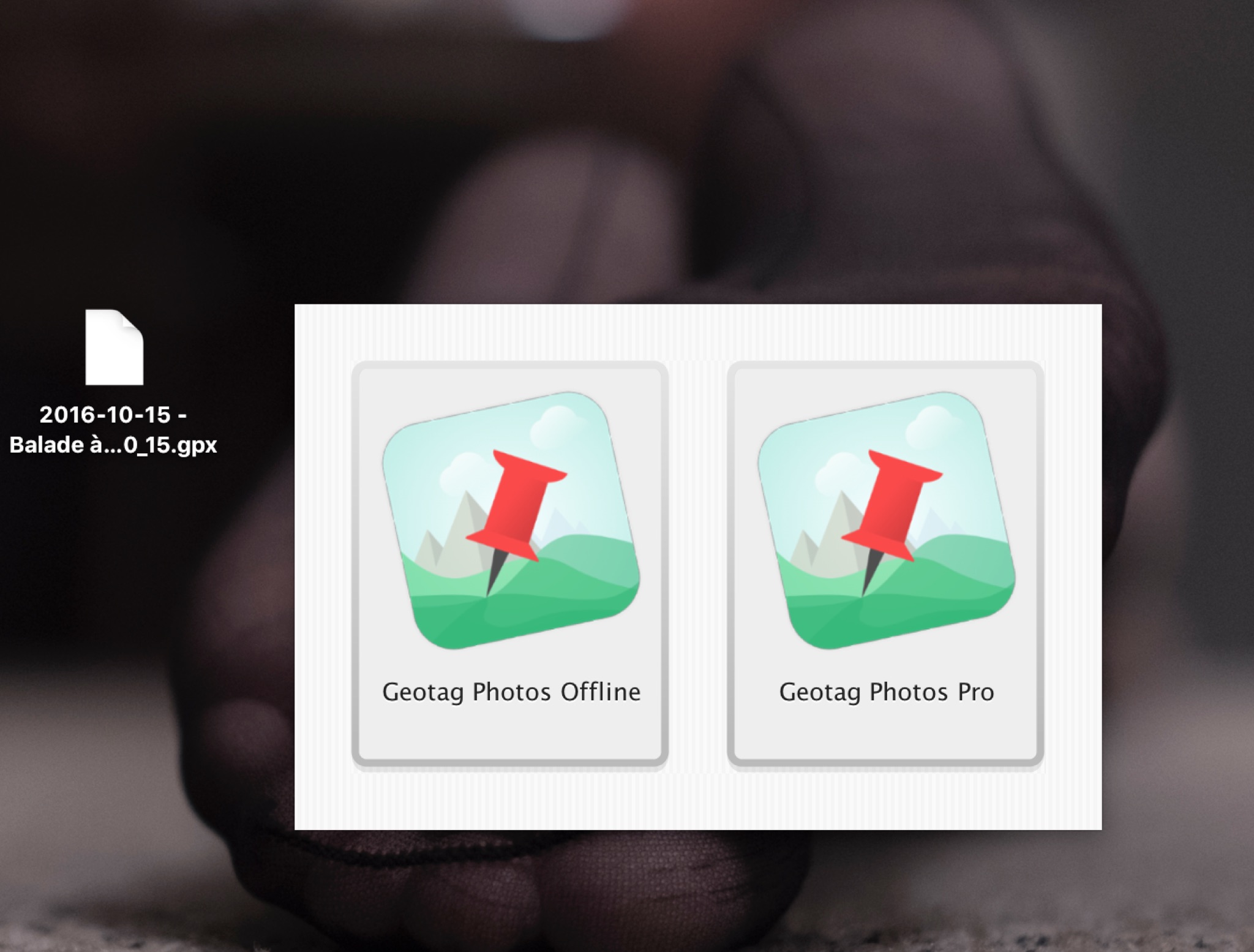
[](https://i0.wp.com/www.macarel.fr/wp-content/uploads/2016/10/geotag01.png)
So choose the icon on the left, "Geotag Photos Offline":
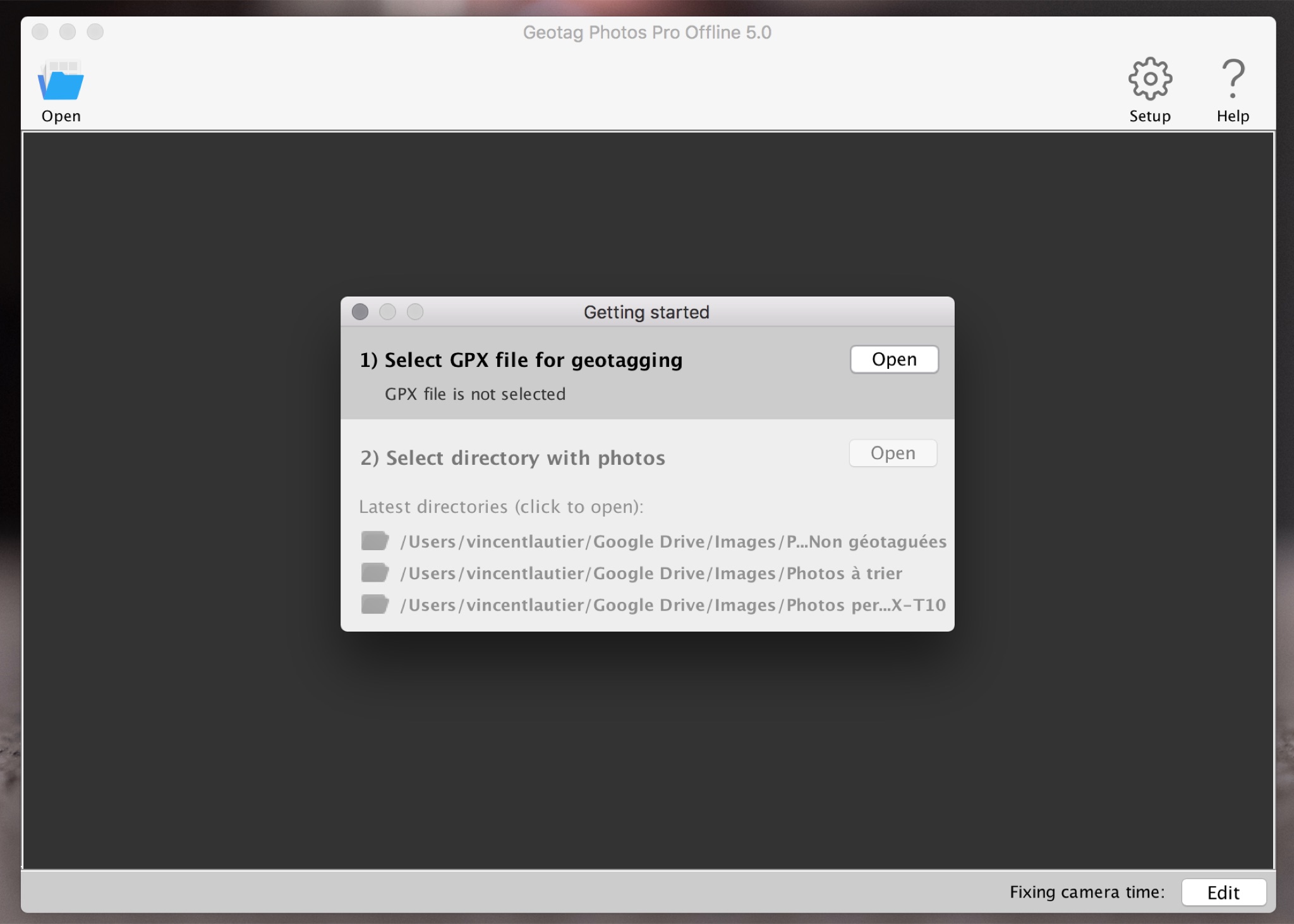
[](https://i0.wp.com/www.macarel.fr/wp-content/uploads/2016/10/geotag02.png)
Select your .gpx file that you just retrieved from your phone:
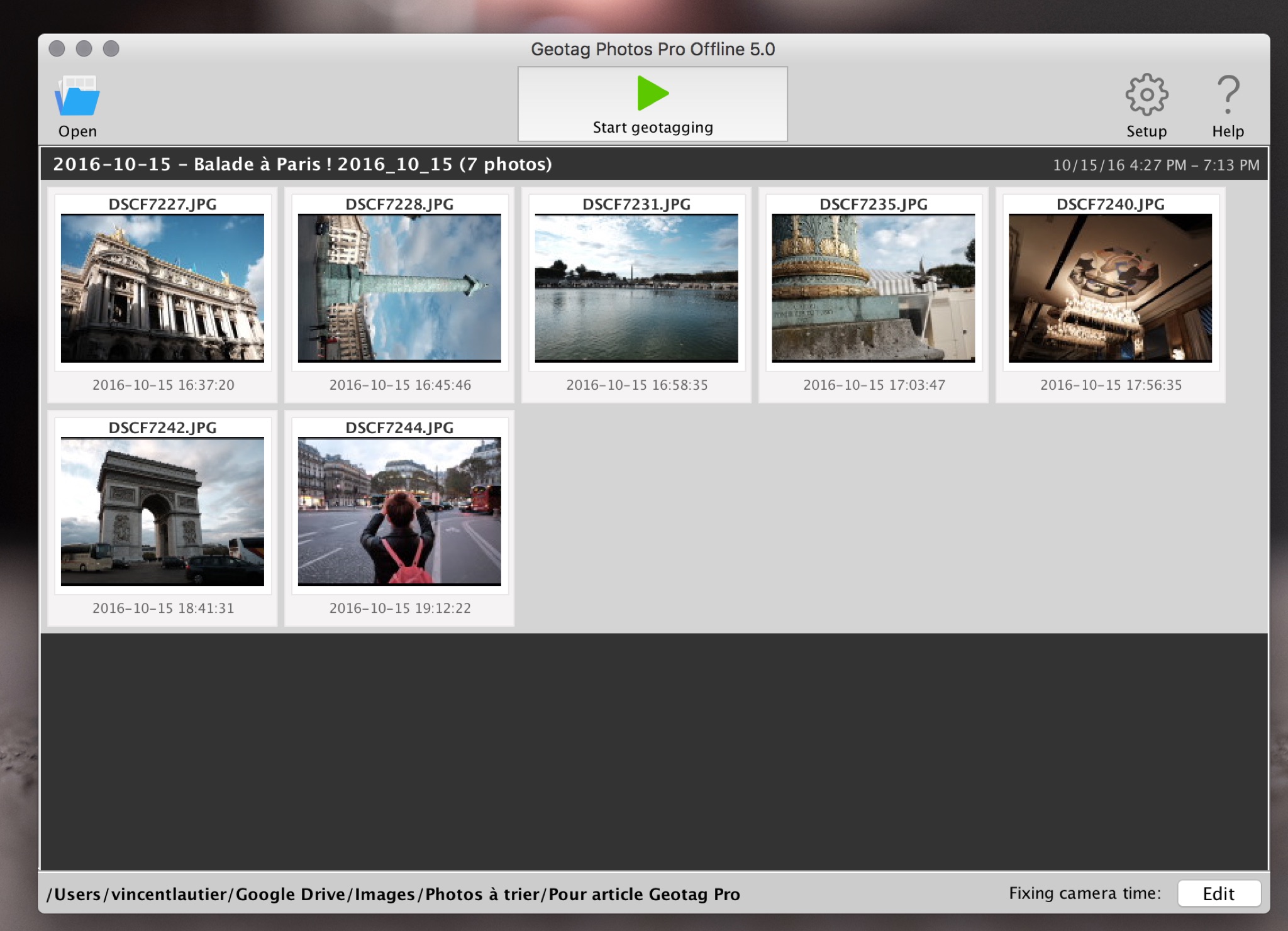
[](https://i0.wp.com/www.macarel.fr/wp-content/uploads/2016/10/geotag03.png)
Add your photos! You just have to point it to the folder:
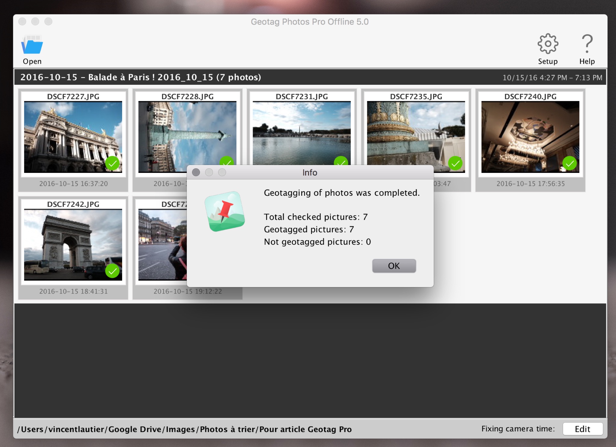
[](https://i0.wp.com/www.macarel.fr/wp-content/uploads/2016/10/geotag04.png)
You click on "Start" and BAM, all your photos are geotagged!
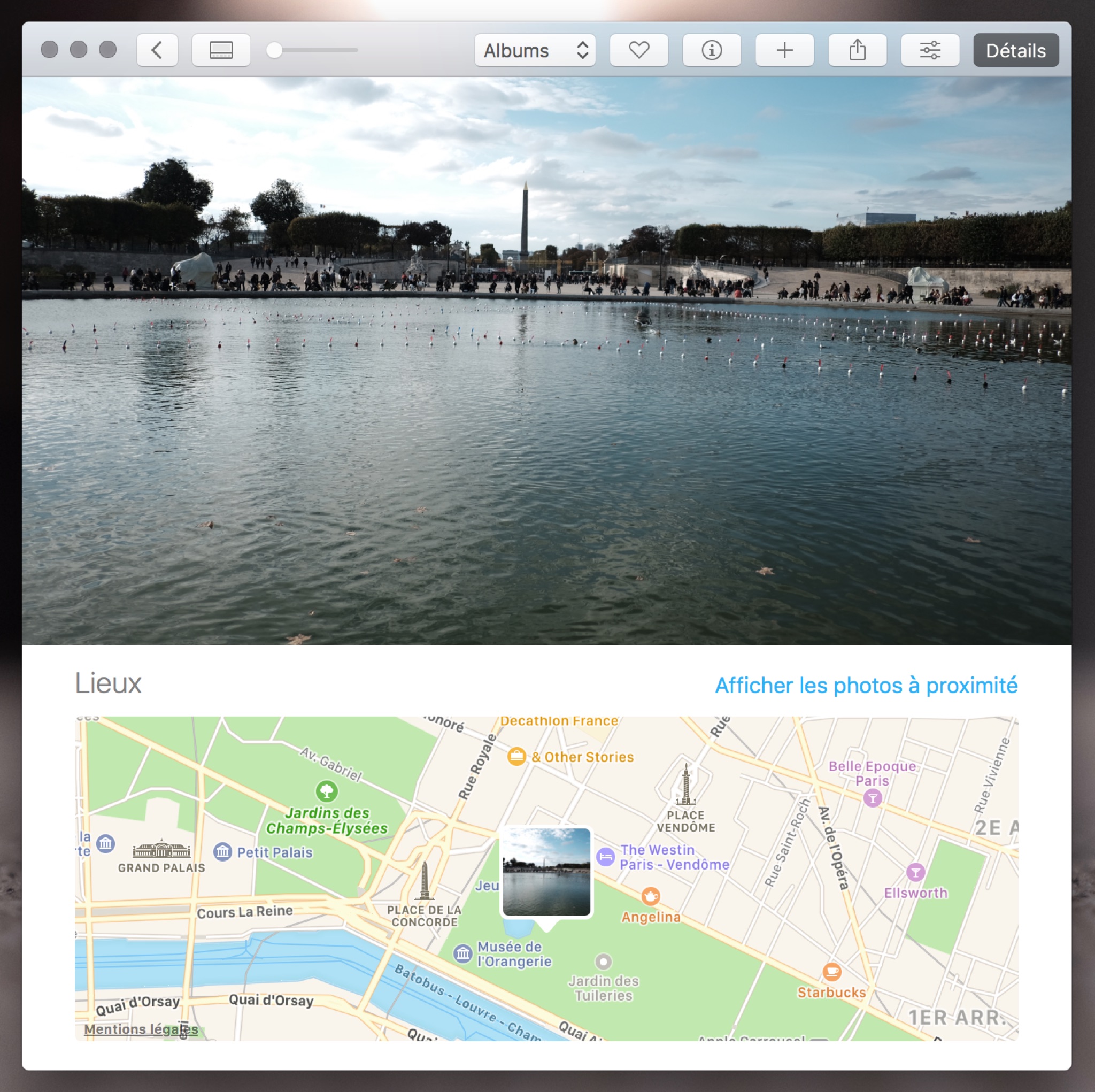
Magic! Concretely it looks like this (see below) when you open your photos in your Photos software, with the maps and everything. Not bad, right?
[](https://i0.wp.com/www.macarel.fr/wp-content/uploads/2016/10/geotag05.png)
Alright, here are a few questions and answers:
- Damn, this looks super tedious, no? Well no, it's simpler and faster to do than it looks, but I couldn't manage to shorten and simplify how this article reads.
- What happens if my times aren't synced between my phone and my camera? It's possible to fix that in the Geotag app, on your computer, it's pretty simple even.
- Do you do this every time you take photos? When I think about it yes, and when I forget (often), I regret having forgotten.
Alright, to conclude and for the most curious, who'd like to analyze the EXIF data of my test photos, I'm sticking them all below! (there's one that's rotated, it's WordPress's fault and I can't be bothered to fix the thing).
Photo credit: DR
By Paingout